Apr 15 (IPS) — Winning a battle for survival requires understanding the opponent. And, for the peoples of 22 island nations and territories scattered across more than 155 million square kilometres of Pacific Ocean, the volatility and wrath of the climate are their greatest threats.
The region harbours three of the world’s most disaster-prone countries, while eight are among those that suffer the highest disaster-related losses to Gross Domestic Product (GDP).
But decision-makers at all levels across the region are grappling with a lack of reliable, detailed information about the connections between climate extremes and changes occurring on their islands. In a bid to bridge the deficit of data, the regional scientific and principal organisation, the Pacific Community (SPC), is spearheading a new project, called Digital Earth Pacific, to capture extensive satellite information about climate change and natural disasters in the region.
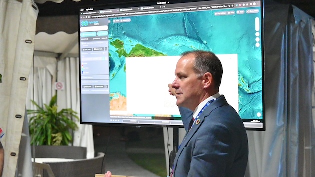
“This is a real first for the Pacific and will bring incredible value to the region, which is so vast, but managed and stewarded by a small number of overstretched people in our member governments,” Dr Stuart Minchin, Director-General of the Pacific Community in Noumea, New Caledonia, told IPS.
“Digital Earth Pacific provides a solution to the tyranny of distance that our Pacific people have to live with every day, allowing operational earth observation satellites to assist in monitoring and management of the vast Blue Pacific Continent,” he continued.
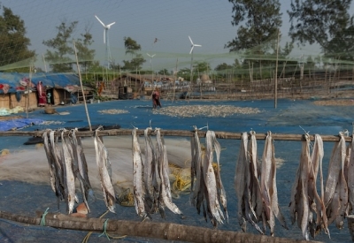
Satellites provide an invaluable timeline of pictures, past and present, of the ways climate change and natural disasters are affecting coastlines, forest cover, population centres, and food production.
The Pacific Islands are home to about 12.7 million people and natural disasters are leading to annual average losses in the region of USD 1.07 billion, reports the Australian Aid Agency.
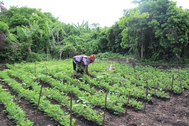
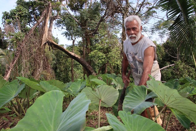
Digital Earth Pacific, launched by the Pacific Community in October last year, aims to halt that trend. To do this, it will set up far-reaching digital public infrastructure that gives national leaders, decision-makers, policymakers, and citizens, including farmers and local communities, easy access to up-to-date satellite-derived information. It will equip islanders to make better decisions about everything from building climate-resilient infrastructure to planting crops.
The project will draw on the wealth of scientific information from Microsoft’s Planetary Computer and treat it as ‘public goods’ to be used by those who need it. It is now in the last stages of the first phase of development, with significant progress already made in establishing the digital infrastructure and designing products and applications. Minchin said that they had captured “coastline change, mangroves, and surface water resources, and each of these products is available for every island atoll and rock across the entire Blue Pacific Continent.”
This is only “the beginning, though, with a significant pipeline of other products in development, bringing the region not just a historical view of how these issues have impacted local areas but an ongoing operational monitoring tool that will be updated regularly with new satellite observations,” Minchin explained.
The development of products and services has been informed by extensive consultations with Pacific Island countries. “The insights from the consultations gave the project a very good indication of what kind of baseline data is missing and where earth observations can fit in for sound decision-making,” Sachindra Singh, the Geoinformatics Team Leader in the Pacific Community’s Geoscience Division in Suva, Fiji, told IPS.
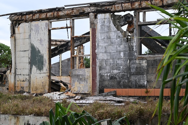
There is no Pacific Island nation that has not suffered the blow of devastating cyclones, the merciless corrosion of land by the sea or human hardships when the necessities of food and water perilously decline in the face of droughts or saltwater contamination.
This century, the Pacific faces a forecast of relentless temperature increases, extreme rainfall, and floods that risk the perishing of crops and rises in human illness and disease, such as heat stress and dengue fever, reports the Intergovernmental Panel on Climate Change (IPCC). More destructive cyclones and rising sea levels will lead to continued loss and damage to towns, villages, and basic services, for instance, water, sanitation, power, and roads.
In recent years, the region has been burdened with exorbitant loss and damage bills from cyclones. In 2015, Cyclone Pam cost Vanuatu USD 449.4 million, while Cyclone Winston, which descended on Fiji in 2016, caused damages to the value of US$600 million.
Pacific Island nations cannot afford the escalating economic consequences of climate disasters. Especially because ‘countries in the Pacific region commonly face low GDP growth, high reliance on grants and external loans and under-development in disaster-resilient infrastructure, the economic impact of natural disasters tends to be larger than for other comparable low-income and emerging economies,’ reports the International Monetary Fund (IMF).
The new digital project is, therefore, an essential tool for prevention, ensuring that islanders can act effectively before the next disaster hits and build lives that are resilient to climate excesses in the decades ahead.
At this stage, the project will have operational products ready to use by 2024.
"All this information is made easily accessible through the Digital Earth Pacific website in a user-friendly viewer,” Singh said.
Users can then “identify how their shorelines have changed over time, what areas of their islands are floodprone or have historically faced droughts. They will be able to identify how the health of their mangroves recovers after a severe tropical cyclone and monitor the progress of replanting efforts over the years,” he continued.
A major beneficiary will be the Cook Islands, a self-governing group of 15 islands, including low-lying coral atolls, located between Tonga and French Polynesia. It has a population of about 17,500 people who live on a total island landmass of 240 square kilometres. Here, people contend with limited land for food production, an expanding population, and constrained water resources. And, from November to April each year, the country is exposed to tropical cyclones.
John Strickland, Director of Emergency Management in the Cook Islands, told IPS that the country was particularly prone to cyclones, flooding, sea surges, and drought.
“With 30 years of satellite data collected through Digital Earth Pacific... has provided images of how the Cook Islands’ coastal area has been affected by climate change, also indicating water observations during floods,” Strickland said.
“With the data captured, this will assist the Cook Islands in future planning on ensuring that affected coastal and low-lying areas affected by floods are captured and monitored. It will provide us the ability to report on affected areas and forecast, in future, zones that are vulnerable during a disaster.”
The Pacific Community also believes that access to the data will aid economic growth by informing better investment and planning by local industries and businesses.
Bringing such a massive infrastructure scheme to fruition will take an equally sizeable investment. And the Pacific Community is currently seeking donors and partners who will help the vision become reality.
“We have already received strong support from the National Oceans and Atmospheric Administration (NOAA), the United Kingdom and New Zealand governments and the Patrick J. McGovern Foundation, allowing us to develop the Digital Earth Pacific capability for the first year or two of operation and we are very grateful for this support to date,” Minchin said. But he emphasised that ongoing financial and technical support is vital in the coming years.
Ultimately, the Pacific Community’s goal is to give islanders the power to forge sustainable lives, limit climate-related poverty, reduce fiscal exposure, and retain their sovereignty.
IPS UN Bureau Report